TL;DR — THE 30-SECOND VERSION
20,000 years ago, you could walk from Malta to Sicily. A 90 km limestone land bridge connected them during the Ice Age. Dwarf elephants the size of large dogs used it. A study by Rossi et al. (received 2024; published 2025) produced the first detailed reconstruction of the western coastline — revealing hidden lagoons and barrier islands now 119–131 metres underwater. Malta sits on the African Plate (Pelagian Block), not the European Plate, was built from 30 million years of marine sediment, and is still slowly sinking.
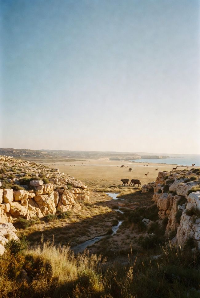
Stand on the Dingli Cliffs today. Nothing but blue water toward Africa.
Twenty thousand years ago, the sea was gone from this coast. The Malta Plateau was emergent — a continuous limestone plain, 40 kilometres wide, stretching 90 kilometres north to southeast Sicily. Not a narrow causeway. An entire landscape.
Dwarf elephants roamed it. Deer crossed it. Wolves hunted on it.
Then the ice melted, the seas rose, and it vanished.
⚡ The land bridge is now drowned beneath the Malta Plateau — invisible without a research vessel and seismic survey equipment. But a study by Rossi et al. (published 2025) has given us the clearest picture yet of what it looked like.
Born on the Seafloor
How 30 million years of marine snow built an archipelago

Every cliff face in Malta is a library. The honey-coloured Globigerina limestone that gives Valletta its glow? Microscopic shells of planktonic foraminifera (single-celled marine organisms). Drifting down through warm Miocene seas. Millions of years of marine snow, compacted into building stone.
The hard grey Lower Coralline Limestone at the base of Dingli’s cliffs is older still. Late Oligocene. Roughly 28 to 23 million years ago.
— Malta sits on the African Plate, not the European Plate. —
Here’s what most accounts skip entirely: Malta is part of the Pelagian Block, a continental platform on the African Plate. It sits between Sicily and Libya, about 200 km south of where the African Plate dives beneath the Eurasian Plate.
While mountain belts were being thrust skyward to the north, Malta’s corner of Africa was quietly accumulating sediment in shallow, sun-drenched waters.
💡 Quick Take: The entire Maltese rock sequence is only about 250 metres thick and took 21 million years to form. Five formations, bottom to top: Lower Coralline Limestone, Globigerina Limestone, Blue Clay, Greensand, Upper Coralline Limestone. No volcanic or metamorphic rocks exposed anywhere. No basement rock visible on any island.
That last detail matters. Malta is one of very few places in the Mediterranean where you can see a stratigraphically complete and unusually legible Oligo-Miocene sedimentary succession standing above sea level.
The Maltese Lower Globigerina Limestone is so significant that the International Union of Geological Sciences designated it a Global Heritage Stone Resource in 2019. One of only a handful of rocks in the world with that recognition.
Cracked and Tilted
The faults that carved the islands into existence
Sedimentation wrote Malta’s pages. Tectonics ripped out a few chapters.
Two perpendicular fault systems sliced the archipelago into its current shape. Understanding them explains almost everything about Malta’s landscape — including why the megalithic temples sit where they do.
Fault System #1: The Old Set (ENE–WSW)
Dating to the Early Miocene, striking 50° to 70°. These created Malta’s miniature basin-and-range landscape: alternating raised horst blocks (uplifted slabs) and dropped graben troughs (down-faulted basins).
The results: the South Malta Horst, the North Malta Graben, and the Gozo Horst. The Great Fault — with vertical displacement exceeding 100 metres — runs right through the island.
🧭 Walk along the Victoria Lines on the Great Fault scarp and you’re literally standing on the boundary between two fault-bounded blocks that moved relative to each other.
Fault System #2: The Young Set (NW–SE)
Active from the Late Miocene onward, nearly perpendicular to the older set. Associated with the Pantelleria Rift, whose trough drops to 1,300–1,700 metres just south of the islands — far beyond the lonely islet of Filfla.
Instrumental seismicity indicates the region remains tectonically active.
💡 Quick Take: The two perpendicular fault systems — consistent with a major rotation of the regional stress field over roughly 10 million years — tilted Malta to the northeast. That’s why dramatic cliffs line the southwest coast while the northeast slopes gently into the sea. It’s also why Valletta’s Grand Harbour exists. The famous twin harbours are drowned river valleys — products of rift tectonics.
There’s also an underappreciated wildcard: salt tectonics. Gravity surveys reveal kilometre-wide circular domes and depressions across Malta that don’t match the known fault patterns. They’re likely caused by halokinesis (slow flow of buried salt deposits). Still an active area of research.
The Great Drying
Setting the stage for the land bridge
Before the ice ages, Malta witnessed one of Earth’s most extraordinary geological events: the Messinian Salinity Crisis (5.96 to 5.33 million years ago).
The Mediterranean lost its Atlantic connection. Evaporation ran wild. Sea levels in the basin may have plummeted by more than a thousand metres in the deepest areas.
For the Malta Plateau, this created a deeply eroded surface that became a crucial stratigraphic marker. When Rossi’s team analysed their seismic profiles, this irregular Messinian erosional surface was the boundary between the older Oligo-Miocene rocks and the younger Plio-Quaternary deposits sitting on top.
⚡ The Plio-Quaternary deposits on the plateau are remarkably thin — only 19 metres at one well location, 38 metres at another. This thinness is precisely why the older Messinian erosion surface is still legible in seismic profiles: there’s almost nothing on top of it to obscure the signal. The land bridge surface was largely bare limestone with thin soil cover. Not a sandy beach. A rocky steppe.
Walking to Sicily
The Last Glacial Maximum land bridge in unprecedented detail
During the Last Glacial Maximum (roughly 26,500 to 19,000 years ago), ice sheets locked up so much water that global sea levels dropped 120–130 metres.
In most places, this exposed a fringe of continental shelf. In the Sicily Channel, it did something far more dramatic.
90 km × 40 km
Approximate dimensions of the Malta–Sicily land bridge at maximum extent (~20,000 years ago)
All of Malta’s islands fused into a single landmass — Malta, Gozo, Comino — and that combined island fused to southeast Sicily. The channels between the islands became shallow valleys, probably carrying seasonal streams.
What the Bridge Actually Looked Like
This is where the Rossi et al. (2025) study makes its biggest contribution.
Using 2D multichannel seismic profiles (a geophysical method that images subsurface rock using sound waves) from old oil exploration surveys, combined with EMODnet (European Marine Observation and Data Network) bathymetric data, the team reconstructed the western coastline of the land bridge in detail for the first time.
The western shoreline sat at depths of 119 to 131 metres below present sea level (all depths are present-day water depth below modern sea level).
— The western edge featured barrier islands and coastal lagoons — not a bare cliff dropping into the sea. —
Structural highs in the underlying rock acted as natural barriers, with younger sediments lapping against them (a geometry geologists call onlap). Behind these low chains of carbonate highs, sheltered lagoons developed — biologically productive shallow-water environments, ecologically distinct from the exposed limestone steppe further inland.
❓ The eastern coastline remains poorly understood. The seismic data on that side is less extensive, and more intense wave and current erosion has obscured the LGM-era features. Mapping the eastern half is an open research challenge.
The Megafauna Highway
Dwarf elephants, giant dormice, and the bones that proved the bridge existed

The most charismatic evidence comes from Għar Dalam cave on Malta’s southeast coast.
Its stratigraphy reads like a compressed history of the island (layer ages are approximate and depend on dating method and calibration):
| Layer | Contents | Approx. age |
|---|---|---|
| TOP | Cultural layer — first Neolithic farmers | ~7,500 years ago |
| ↓ | Deer layer — red deer, aurochs, boar | ~18,000 years ago |
| ↓ | Pebble layer | Transitional |
| BOTTOM | Dwarf elephants, hippos, giant swans, giant dormice | 500,000+ years ago |
Elsewhere on Malta: Latnija Cave in Mellieħa preserves Mesolithic hunter-gatherer occupation dating to around ~8,500 years ago — roughly a millennium before the first Neolithic farmers. Evidence published in Nature (Scerri et al., 2025) indicates these early visitors crossed around 100 km of open water, likely in simple craft such as dugout canoes. Published analysis describes these as the longest currently known hunter-gatherer sea crossings in the Mediterranean, and among the earliest evidence of hunter-gatherer long-distance seafaring before sails.
The Dog-Sized Elephant
The elephant story is far more complex than most accounts let on. At least three species of Palaeoloxodon are recognised from Malta, representing multiple colonisation events over hundreds of thousands of years.

98%
Body mass reduction from ancestor to dwarf: P. antiquus (~11,500 kg) → P. falconeri (~250 kg)
Palaeoloxodon falconeri stood less than a metre tall. Roughly the size of a large dog.
But here’s the part nobody tells you: despite their tiny size, they kept the life history of full-sized elephants.
🐘 Bone histology suggests P. falconeri grew very slowly, likely reaching sexual maturity around ~15 years (older than modern African elephants), with some individuals possibly living at least 68 years (Köhler et al., 2021). Small but long-lived — a fascinating evolutionary solution to island resource constraints without speeding up the life cycle. One of the most shareable facts in Maltese palaeontology.
The larger species, P. mnaidriensis, arrived ~200,000 years ago and was bigger than P. falconeri. Why? Predators had arrived too — cave hyenas, cave lions, wolves, bears had crossed the Strait of Messina. Bigger body = better survival odds.

The Timing Problem
Note: this is the Calabria–Sicily crossing at Messina, separate from the Malta Plateau land bridge further south.
The Strait of Messina (currently ~3–5 km wide) sits over a sill at about 81 metres depth. During the LGM, it became dry land for centuries to possibly over a millennium, centred around 21,500 to 20,000 years ago (estimates vary with the sea-level curve used).
For the first time in hundreds of thousands of years: a potentially continuous terrestrial corridor from continental Europe through Sicily to Malta, depending on sea level and local sill geometry. Even with low sea level, whether the full corridor was walkable at any given moment depends on local sill depths and short-term sea-level oscillations.
But here’s the twist. The last known Sicilian elephants are often placed around ~32,000 years ago (Masseti, 2001) — before the LGM bridge fully formed. By the time the corridor opened wide, it was deer and cattle walking to Malta, not elephants.
💡 Quick Take: The deer layer in Għar Dalam represents the continental fauna that replaced the endemic island species. Red deer, aurochs, wild boar — all arriving via the LGM land bridge from Italy through Sicily.
The Drowning
How rising seas erased a country-sized landmass
Not a catastrophe. A slow drowning.
After ~18,000 years ago, melting ice sheets sent sea levels climbing. Not at a constant rate — pulses of rapid rise alternated with periods of stability — but the trend was relentlessly upward.
On a low-gradient shelf like the Malta Plateau, even small sea-level changes meant enormous horizontal shifts in the shoreline.
⚡ During slow rise: barrier-lagoon systems formed and migrated landward. During rapid pulses: barriers drowned in place — overtopped so fast they were preserved rather than eroded. The speed of the drowning was their preservation. That’s why Rossi’s team can still see them in seismic data 20,000 years later.
| When | What happened |
|---|---|
| ~20,000 years ago | Maximum land bridge extent. Walk from Malta to Sicily. |
| ~18,000 years ago | Ice sheets begin collapsing. Sea levels start rising. |
| ~14,000–15,000 years ago | Land bridge breached. Malta becomes isolated. |
| ~11,000 years ago | Islands reach roughly modern configuration. |
| ~8,500 years ago | Hunter-gatherers reach Malta by sea (Latnija Cave, Nature 2025). |
| ~7,500 years ago | First Neolithic farmers arrive with crops and livestock. |
But the submergence didn’t stop. Malta’s coasts show evidence of ongoing subsidence — the islands are gently sinking as well as being flooded by rising seas. A double whammy that’s been reshaping the shoreline for millennia.
What Lies Beneath
The submerged landscape is a time capsule
The drowned land bridge isn’t featureless seabed.
Surveys have revealed submerged river channels, alluvial deposits, and former woodland habitats. The Malta Plateau — lacking significant river input — formed distinctive tide-wave bedforms instead of the typical sediment wedges found on other Mediterranean shelves. For more on Malta’s relationship with water through the ages, see our guide to Malta’s water history.
— We still don’t know whether humans used the land bridge before it drowned. —
Homo sapiens reached Sicily by at least 20,000 years ago. The land bridge was still crossable until ~14,000 years ago. A 2025 Nature paper (Scerri et al.) proved that hunter-gatherers reached Malta by sea ~8,500 years ago — crossing 100 km of open water, likely in simple craft such as dugout canoes. Neolithic farmers followed ~7,500 years ago — the same people who would eventually build the megalithic temples.
But what happened between 14,000 and 8,500 years ago remains blank. Did anyone walk the bridge before it drowned? Did earlier seafarers visit and leave no trace? The evidence, if it exists, is underwater — perhaps alongside the shipwrecks that already draw divers to Malta’s depths.
The Malta Plateau, with its thin sediment cover and relatively gentle disturbance, may be one of the better-preserved submerged prehistoric landscapes in the Mediterranean. Investigating it will require high-resolution geophysical surveys, targeted coring, and potentially underwater archaeology. Expensive. Technically demanding. Potentially transformative.
🔬 UPDATE: ACTIVE RESEARCH UNDERWAY
From 29 December 2025 to 7 January 2026, the BRIDGES oceanographic expedition sailed aboard the R/V Gaia Blu, a collaboration between Italy’s CNR-ISMAR, the OGS, and the University of Malta. The mission’s goal: to identify and map the remains of the ancient land bridge using high-resolution geophysical surveys. Principal investigators: Maria Filomena Loreto (CNR-ISMAR) and Emanuele Lodolo (OGS). This is exactly the kind of dataset that could finally constrain the eastern coastline and the timing of final severance.
From Papers to Tourism
Why this matters for anyone visiting Malta
Cappadonia et al. (2018) argued that the shared geology between Malta and Sicily should become a cross-border geosite network.
Their insight: the Miocene–Pliocene stratigraphy of both regions is continuous. Same formations, same seas, now separated by the water that re-flooded the plateau. Visiting Globigerina Limestone in Valletta and equivalent units in Sicily’s Hyblean Plateau is visiting two parts of the same outcrop.
🎯 A geotourism itinerary could link Għar Dalam → Dingli Cliffs → Victoria Lines → Latnija Cave (the 2025 Mesolithic discovery) → offshore research sites. Across the water: the Iblean Plateau, Spinagallo Cave, Puntali Cave. Two halves of the same story.
For a destination already attracting deep-history visitors (Megalithic Temples, Ħal Saflieni Hypogeum), the land bridge narrative extends Malta’s story from 5,000 years to 500,000 years and beyond.
Continental drift. Climate change. Evolution. Extinction. The fundamental impermanence of geography.
All told through rocks you can touch and caves you can walk into. For the full sweep of Malta’s history — from these geological origins through Phoenician traders, the Great Siege, and beyond — explore our Malta History Timeline.
What We Still Don’t Know
- The eastern coastline of the LGM land bridge is essentially unmapped at high resolution
- The precise timing of the bridge’s final severance is constrained only within a few-thousand-year window
- We know almost nothing about the vegetation that covered the exposed plateau
- Whether humans used the land bridge before it drowned (~14 ka) — the gap between bridge submergence and earliest known human presence (~8.5 ka) is still unexplained
- Salt-tectonic anomalies visible in gravity surveys need follow-up investigation
- Ongoing seismicity at fault intersections has unexplored hazard implications
Most of this uncertainty exists because we are reconstructing a drowned landscape from indirect geophysics plus sparse cores — the direct evidence is 50 to 130 metres underwater.
We now know people reached Malta by sea ~8,500 years ago, and farmers by ~7,500 years ago. But the bridge was crossable until ~14,000 years ago. That’s a 5,500-year gap between the bridge drowning and the earliest known human presence — still wide open.
Glossary
| Foraminifera | Single-celled marine organisms whose calcium carbonate shells accumulate as limestone. |
| Horst | An uplifted block of rock between two parallel faults. |
| Graben | A down-dropped block of rock between two parallel faults. |
| Halokinesis | The slow subsurface flow of salt deposits, which deforms overlying rock layers. |
| Onlap | A sedimentary pattern where younger layers thin out and terminate against an older surface. |
| EMODnet | European Marine Observation and Data Network — a shared bathymetric database. |
| Multichannel seismic | A geophysical survey method using sound waves to image subsurface rock layers beneath the seafloor. |
| LGM | Last Glacial Maximum (~26.5–19 ka) — the peak of the most recent ice age. |
| Pelagian Block | A fragment of the African continental plate underlying the Sicily Channel, Malta, and parts of Libya/Tunisia. |
Key Research & Further Reading
Rossi et al. (received 2024; published 2025) — Earth Surface Processes and Landforms, DOI: 10.1002/esp.6061. First detailed LGM western coastline reconstruction using repurposed oil-exploration seismic data. The barrier-lagoon discovery.
Scerri et al. (2025) — Nature, DOI: 10.1038/s41586-025-08780-y. Hunter-gatherer sea voyages extended to remotest Mediterranean islands. The Latnija Cave discovery pushing Malta’s human history back to ~8,500 years ago.
Cappadonia et al. (2018) — Geosciences 8(7), 253. Cross-border geosite network proposal based on shared stratigraphy.
Alexander (1988) — Quaternary Science Reviews 7(1), 41–53. Foundational paper on Malta’s tectonics, faunal evidence, and Quaternary subsidence.
Todaro et al. (2022) — Marine Geology. Distinctive tide-wave bedforms on the Malta Plateau during the LGM.
Furlani et al. (2013) — Holocene sea level change and evidence of ongoing Quaternary subsidence beyond global eustatic change.
Foglini et al. (2016) — Combined multibeam/LiDAR/Chirp paleolandscape reconstruction from LGM to present.
Köhler et al. (2021) — Scientific Reports 11: 22862, DOI: 10.1038/s41598-021-02192-4. Palaeohistology reveals a slow pace of life for the dwarfed Sicilian elephant. Source for maturity ~15 years and minimum lifespan 68 years.
Masseti (2001) — In The World of Elephants — Proceedings of the 1st International Congress, Rome. Holocene and Late Pleistocene Sicilian elephant extinction chronology.
IUGS Geoheritage (2019) — Global Heritage Stone Resource designation for Maltese Lower Globigerina Limestone.
The land bridge is gone. Dissolved back into the sea that made the limestone it was built from. But its traces are everywhere — in the bones at Għar Dalam, in the hearths at Latnija, in the faults that carve the landscape, in the seismic echoes bouncing off drowned lagoon barriers 119–131 metres below the surface.
Malta is a small island. Its geological story is immense. And it’s still being written.
— ManicMalta.com
Image Credits
Dingli Cliffs photograph: Felix König, Wikimedia Commons, CC BY 3.0
Globigerina limestone quarry, Gozo: Wikimedia Commons, CC BY-SA 3.0
Għar Dalam cave interior: Wikimedia Commons, CC BY-SA 3.0
Palaeoloxodon falconeri size comparison: SlvrHwk, Wikimedia Commons, CC BY-SA 4.0
Għar Dalam elephant display: Wikimedia Commons, CC BY-SA 3.0
Stay in Gżira near the promenade

A designer 2-bedroom apartment in Gżira, close to the church, around 2 minutes from the promenade, and near Manoel Island.
View on Airbnb