- The Honest Take
- Walk Sliema: A Half-Day Route
- The Promenade
- Beaches and Swim Spots
- Pools and Lidos
- Malta’s Water History
- Fort Tigné and Dragut Point
- Manoel Island
- Shopping
- Churches, Theatres and Architecture
- The Ferry to Valletta
- Water Sports, Boat Tours, and the Water Taxi
- Day Trips from Sliema
- Where to Eat
- Nightlife
- Annual Events and Festas
- Getting Around
- Practical Stuff: Supermarkets, Pharmacies, Costs
- Where to Stay
- Best Time to Visit
- FAQ
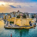
Sliema: The Honest Take
The word “Sliema” means peace in Maltese — from “Sliem Għalik Marija,” the opening of the Hail Mary prayer. That name made sense when this was a fishing village with a chapel on a rocky peninsula. It makes less sense now. Modern Sliema is Malta’s main commercial and tourist hub, a dense strip of high-rise apartments, international restaurants, and shopping centres running from Tigné Point to the border of St Julian’s. Population around 23,000, swelled further by a large international workforce — Malta’s iGaming industry has drawn thousands of Scandinavian and other European workers to the area over the past decade.
I walk through Sliema most weeks, usually along the promenade or cutting through the backstreets to Bisazza Street. It’s changed enormously even in the last five years — some of that for the better, some not. But for visitors, it’s still one of the most practical bases on the island. The ferry to Valletta runs every half hour, the bus connections are solid, and you can reach the Blue Lagoon, Mdina, or the airport without renting a car. For deeper background on how this fishing village became Malta’s commercial centre, there’s a full history of Sliema.
What I’ll say upfront — the negatives:
- No real sandy beaches — Balluta Bay has a small pebbly strip, but that’s about it. I’m not a sand person personally — it’s messy
- Ongoing development has claimed many of the old Victorian-era villas that once lined Tower Road
- Traffic and parking are awful — Sliema is one of Malta’s worst bottlenecks
People sometimes describe Malta as “Marmite” — you either love it or you don’t. I’ve heard visitors say Sliema specifically is too urban, too concrete, too noisy. Others call it the best base they’ve ever had for exploring a country. The difference, in my experience, is if you arrive expecting a resort or a functioning town. Sliema is a real place where people live and work. If that’s what you want, it delivers. If you want a beach resort, look at Mellieħa instead.
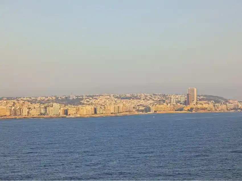
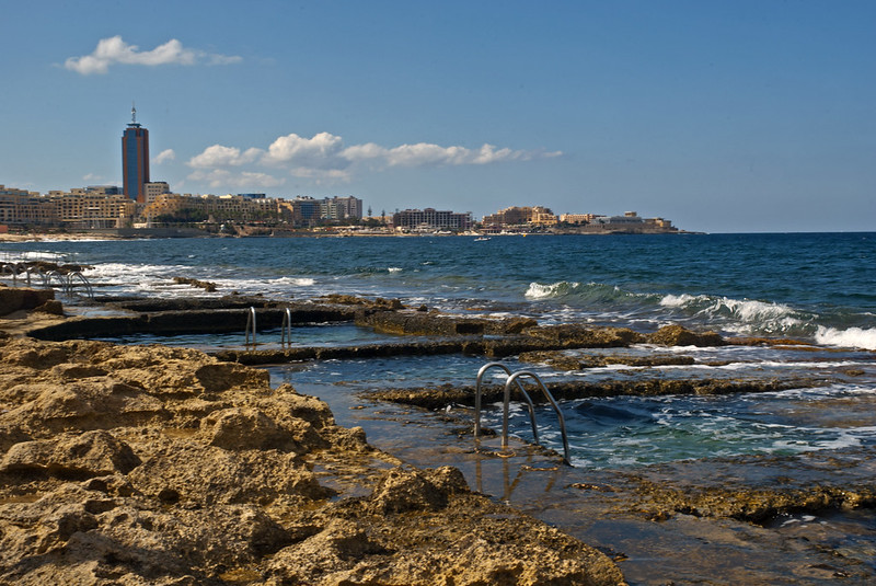
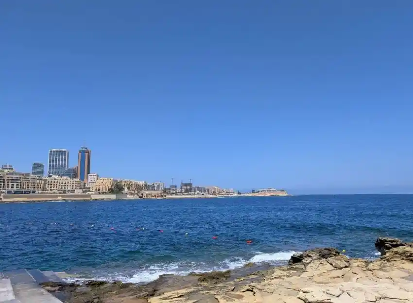
A rare angle. St Julian’s and Sliema as one continuous strip, the way they look from far out at sea.
Walk Sliema: A Half-Day Route
If it’s your first time in Sliema, I’d walk it south to north along the coast — roughly 4km, with stops — covering the main sights without backtracking. Allow 3–4 hours including coffee and browsing time. The terrain is flat and paved the entire way.
1. Tigné Point and Fort Tigné
📍 Google Maps
Allow 30–40 minutes
- Start at the tip of the peninsula. The fort (built 1793–1795) is one of the oldest polygonal forts in the world
- Walk around the exterior — views across to Valletta and Fort Manoel are excellent
- The fort is not always open inside, but the surrounding Tigné Point development is freely walkable
- This is Dragut Point — where the Ottoman corsair was killed during the Great Siege of 1565
2. The Point Shopping Mall
📍 Google Maps
Allow 15 minutes (or more if you shop)
- Malta’s biggest mall — Zara, Mango, Nike, food court, cinema
- Built on the site of the former British Tigné Barracks
- There’s a supermarket inside if you need supplies
- Air-conditioned — worth knowing when it’s 36°C outside
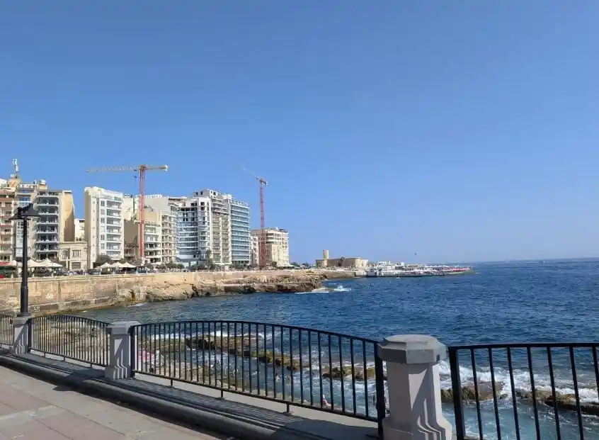
3. The Sliema Promenade (Tower Road)
📍 Google Maps
Walk takes about 20 minutes end to end, but you’ll stop
- Called “The Front” by locals — 2km of unobstructed sea views
- Pass the gabbani (kiosks) selling fresh orange juice for about €2
- Cat colonies on the rocks, fishermen at dawn, the occasional dghajsa (traditional boat) in the harbour
- Benches along the way, but they fill up fast after 5pm on summer evenings
☕ Coffee break: Caffè Berry
📍 Google Maps — near the ferry terminal on San Duminku
Pistachio or hazelnut coffee, vegan cakes, a neighbourhood feel. 10–15 minutes.
4. Sliema Ferries Terminal
📍 Google Maps
Allow 5 minutes to look, or 30 if you’re catching the ferry
- Departure point for the Valletta ferry (every 30 min, €2 single) and most boat tours to Comino
- The iSeeMalta hop-on/hop-off ferry also departs from here
- Main bus interchange for routes to Valletta, Mdina, Buġibba, and the airport
- Public toilets available at the terminal — one of the few reliable ones along this stretch
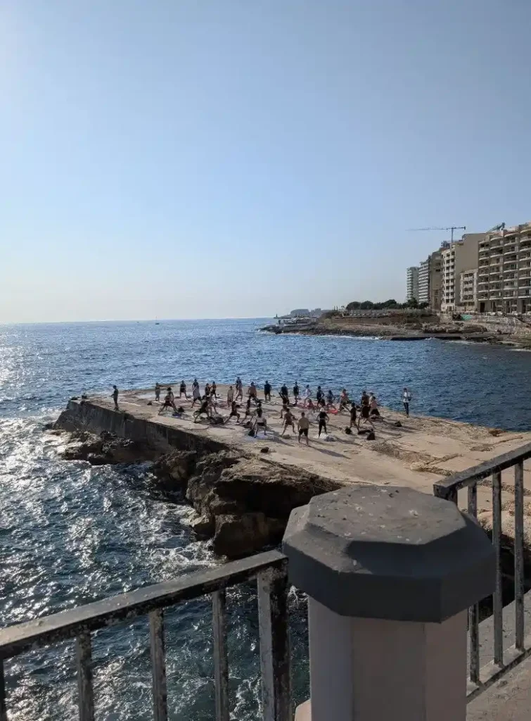
5. Fond Għadir — the “Roman Baths”
📍 Google Maps
Allow 15–20 minutes (more if you swim)
- Rock-cut tidal pools near Surfside restaurant — not actually Roman, despite the name (19th-century salt pans)
- On a calm day, the water is crystal-clear — bring snorkel gear for the wrasse and small octopuses hiding in the rocks
- Free to use, no facilities — bring your own towel and water
- Full history: why Sliema’s baths aren’t Roman
6. Exiles Beach
📍 Google Maps
Allow 15 minutes (or an hour if you’re swimming)
- Narrow pebble strip and flat rocks for sunbathing
- Metal ladders for water entry — seasonal (April–October only)
- Gets packed in July and August
- A few small kiosks nearby for drinks, but no real shade — bring your own
🍽️ Lunch stop: Ta’ Kris
📍 Google Maps — Fawwara Lane, a short walk inland from the promenade
Traditional Maltese cooking. Order the stuffat tal-fenek (rabbit stew). Enormous portions. Book ahead on weekends. Allow 45–60 minutes.
7. Balluta Bay
📍 Google Maps
Allow 15–20 minutes
- The closest thing to a real beach on this stretch — small, pebbly, east-facing (morning sun)
- Piazza behind the bay with cafés — good end point for the walk
- Technically the Sliema–St Julian’s border
- Optional extension: Keep walking 15 minutes to Spinola Bay for seafood restaurants and the LOVE monument
Exiles Beach area — rocky, no sand, and the view toward St Julian’s makes up for it.
The Promenade: Sliema’s Main Event
The Sliema Promenade — called “The Front” by everyone here — runs roughly 2km along the coast from Tigné Point to Qui-Si-Sana and on into St Julian’s. Everyone uses it: joggers at dawn, dog walkers before the heat kicks in, families in the evenings, couples watching the sunset behind Valletta’s skyline. It’s where everyone ends up eventually.
The views across Marsamxett Harbour to Valletta are hard to beat anywhere on the island, especially at dusk when the fortifications glow amber. Along the way you’ll pass:
- Traditional gabbani (kiosks) selling fresh-squeezed orange juice for about €2
- Some older Maltese men fishing from the rocks at first light
- The occasional fruit stall selling seasonal Maltese produce
If you want to keep walking beyond Sliema, you reach Gżira, Pietà, and Msida. All worth a look, and from there it’s a 40-minute walk to Valletta or a 20-minute bus.
Beaches and Swim Spots
Sliema is not a sandy beach destination. I want to be clear about that because the marketing photos sometimes suggest otherwise. What it has is a rocky limestone coastline with carved steps, metal ladders, and tidal pools. On a calm summer day, it works well for swimming and snorkelling. In winter, on a rough day, the sea crashes right over the promenade wall. Before you go:
- The metal ladders are seasonal — usually installed around April/May, removed before winter storms. Without them, entry points are limited to carved rock steps at specific spots
- The water is very clear — 84 out of 87 monitored Maltese beaches scored “excellent” water quality in the most recent EU report
- July and August: locals stake out spots early. If you arrive after 10am, expect competition for flat rocks
- Sea urchins live in the shallower areas — cheap rubber swim shoes from any tourist shop are a good idea
- The sea is deep close to shore at every Sliema spot — there are no sandy shallows. Children who can’t swim need constant watching, and rough weather makes entry dangerous for everyone. If the waves are hitting the promenade wall, stay out
- Occasionally there’s some contamination in the water and parts of the coast are closed, but this is rare
Each spot below runs in order along the coast, south to north — the same direction as the walking route above.
Tigné Point 📍 Map
The coast around the tip of the peninsula has flat limestone and views across to Valletta. It’s exposed — catches more wind and swell than the sheltered side — but on a calm day the water is clean and deep enough for a good swim. The Manta lido is here if you want a pool and a sunbed instead.
Qui-Si-Sana 📍 Map
Flat stones, carved rock pools, and steps into the sea. Quieter than Exiles or Fond Għadir — I think because it’s slightly set back from the main promenade traffic. There’s a large playground right behind it, plus sunbed rental, showers, and a couple of kiosks. What most guides miss: this stretch actually has decent shade in places, which is rare along the Sliema coast. It’s not full tree cover, but compared to the fully exposed rocks at Exiles or Surfside, it makes a real difference with kids. Probably the most comfortable family option along this whole coastline — the sea is still deep off the rocks, but the pools and the shade tilt it in favour of younger visitors.
Għar id-Dud 📍 Map
About 300 metres of jagged rocks and small cliffs near the Preluna Hotel. The stones are smooth enough for sunbathing in places, but it’s not the most comfortable stretch. Better for snorkelling than lounging — the rocky underwater terrain holds more marine life than the flatter sections. I’d pick this spot if I had fins and a mask, not if I wanted to read a book.
Fond Għadir (the “Roman Baths”) 📍 Map
The longest and most popular stretch — between St Julian’s Tower and Il-Fortizza Battery. This is a Blue Flag beach managed by the Malta Tourism Authority with lifeguards in season. The rock-cut salt pans (il-banijiet in Maltese) have been used as swimming pools since the Victorian era. On calm days the water in the pools is shallow enough for wading, while the open sea beyond them is deep and clear. Snorkelling here is good — wrasse, small octopuses, sea bream, and the occasional barracuda. I’ve been told someone spotted a turtle once; I haven’t been that lucky. There are showers, sunbed rental, and a couple of food spots nearby including Surfside restaurant. There’s a separate piece on the baths and their history if that interests you.
Surfside 📍 Map
A long, flat stretch of smooth rock just past Fond Għadir — one of the easiest places to lay a towel and spread out. The bar-restaurant on the rocks doubles as a nightlife spot in summer. Some additional rock-cut pools here too. This is my go-to sunset spot along this whole coast — face west and the sky does its thing over the open Mediterranean.
Exiles Beach 📍 Map
The closest thing to a real beach on the Sliema side — a narrow strip of pebbles and sand at the base of Independence Gardens, a small park with a playground, benches, a fountain, and a resident cat colony. The bay itself is good for swimming (deep, clear) but not safe for young kids who can’t swim — there are no shallow wading areas. Ladders in season. A water sports centre operates from here with equipment rental and dive instruction. Restaurants and cafés right above on the promenade. Gets packed in summer but there’s usually space if you arrive before 10am.
Sliema Pitch 📍 Map
Open sea access plus a seawater swimming pool at the adjacent lido — the pool makes this a better option for families with children who want to splash around without the deep-water risk. On windy days when the sea gets rough, the pool is still usable. A good backup plan when the weather isn’t cooperating.
Balluta Bay 📍 Map
Technically on the Sliema–St Julian’s border. This is the only spot with actual sand — a small pebbly cove that’s fine for sitting on without a towel. The bay faces east, so it catches morning sun and is more sheltered than the open coast. Behind the bay there’s a piazza with cafés and the ornate Balluta Buildings (art nouveau, one of Malta’s most photographed façades). The water outside the bay toward the Sliema seafront is better for snorkelling — the rocky bottom there has more going on underwater, including small caves.
Bonus — Along the Sliema promenade you’ll find St Julian’s Tower (Torri ta’ San Ġiljan), a 1658 coastal watchtower that marks the border. Just beyond it, around 📍 this point, there’s a rocky stretch that’s a good swim spot — less crowded than anything on the Sliema side, cleaner water because it faces open sea, and a short walk from the Spinola Bay restaurants.
For a proper sandy beach day, you’ll need to travel. Golden Bay and Mellieħa Bay are your best bets, both reachable by bus in under an hour. The Malta beach map has everything, and the beach gear and dress code guide is worth checking before you go.
Yoga on the Xalet. The rocks double as a studio when the weather cooperates.
Pools and Lidos
If the rocky coastline doesn’t appeal — or the sea is too rough — Sliema also has pools.
Lidos and beach clubs:
- Exiles Beach Club 📍 Map — right under the promenade at Exiles, with pools, sea access, and a restaurant. Entry is sometimes free on Mondays or reduced to about €5
- Manta 📍 Map (Tigné Point) — newer lido with a pool, restaurant, and a direct view across to Valletta. Kids are fine during the day. Expect to pay €15–25 for a sunbed in summer
- 1926 La Plage 📍 Map — the beach club attached to the 1926 Le Soleil hotel on the Sliema seafront. Pool, sea access, and a restaurant that shifts into something fancier in the evenings. Open to non-guests, May to October
- Aqualuna 📍 Map (Sliema Creek, near the Gżira border) — pool and sun loungers overlooking Manoel Island Marina and Valletta. More of a cocktail-bar atmosphere than a swim-all-day place
- On the Gżira promenade 📍 Map, between Sliema and Gżira, there’s a newer lido spot right on the waterfront with views back toward Valletta — I’ve seen it fill up on summer weekends
Hotel rooftop pools: Several Sliema hotels have rooftop pools that non-guests can sometimes access through day passes or by eating at the hotel restaurant.
- AX The Palace 📍 Map — infinity pool on the 9th floor with 360° views of Sliema and Valletta. The TemptAsian restaurant is up there too
- 1926 Les Bains 📍 Map — indoor pool, outdoor pool, and a heated rooftop pool (the rooftop is small but the views are good)
- Novotel Malta Sliema 📍 Map (technically in Gżira) — rooftop pool and indoor pool, both kept clean
- Courtyard by Marriott Sliema 📍 Map — rooftop pool, central location near Qui-Si-Sana
- Preluna Hotel 📍 Map — outdoor pool and beach club with sea access, on the seafront near Exiles
Lido entry costs €5–10 at the cheaper end, €25–50 at the premium clubs — and most places let you put that toward food and drinks once you’re in. Book ahead in peak summer; some places turn people away at the gate.
Malta’s Water History
The Fond Għadir pools covered above are part of a bigger story. Malta has been figuring out how to source, store, and manage water for thousands of years — from Neolithic cisterns cut into bedrock to the British-era aqueduct that once carried water from Mdina to Valletta. If you’re interested in that kind of thing, the Malta water trail guide traces the full timeline.
Qui-Si-Sana looking toward the Xalet area. One of the few spots along the coast with some shade.
Fort Tigné and Dragut Point
The tip of the Sliema peninsula is called Dragut Point, and the name carries weight. During the Great Siege of 1565, the Ottoman corsair Dragut positioned his cannons here to bombard Fort St Elmo across the harbour. He was killed by return fire — a stray cannonball fragment hit him in the head. The spot where he fell still bears his name, over 460 years later. (The Malta history hub puts the siege in the broader timeline.)
Fort Tigné 📍 Map was built on this same ground between 1793 and 1795 by the Knights of St John — their last major fortification before Napoleon expelled them three years later.
- One of the earliest polygonal forts in the world — a departure from star-shaped bastion designs
- Circular keep modelled on the French réduit de sûreté design
- Resisted the French invasion of 1798 — one of the few forts that did
- Modified by the British through the 19th century: Cambridge Battery (1878–1886), Garden Battery (1889–1894)
- Abandoned after British forces left in 1979; restored by MIDI plc in the 2000s
- On Malta’s tentative UNESCO World Heritage list since 1998
The fort is not always open for public visits, but the surrounding area is freely walkable and the harbour views toward Valletta and Fort Manoel are worth the detour.
Manoel Island
Manoel Island is in Gżira, connected to the mainland by a short bridge — a 0.3km² chunk of history in the middle of Marsamxett Harbour. Fort Manoel was built in 1725 by the Knights and appeared in Game of Thrones. Behind it is the Lazzaretto, a quarantine complex from the 17th century used for plague and cholera victims — one of the oldest quarantine facilities in Europe still standing. There’s also a small duck sanctuary on the island, which is exactly as odd as it sounds. The island is undergoing redevelopment, but you can still cross the bridge and walk around parts of it.
If you’re staying in Gżira, the bridge to Manoel Island is practically on your doorstep. There’s a separate Manoel Island guide and a piece on the Lazzaretto’s quarantine history.
The promenade on the Gżira side, looking across to Manoel Island. This stretch is quieter than the Sliema seafront.
Shopping in Sliema
The Point Shopping Mall at Tigné Point is the largest shopping centre in Malta — Zara, Mango, Pull & Bear, Nike, a food court, and a cinema. It sits on the site of the former British barracks. Beyond the mall, the main shopping streets are:
- Bisazza Street — more local character: smaller boutiques, shoe shops, a hardware store that’s been there for decades
- Tower Road — runs along the promenade, more cafés and casual retail
- The Plaza Shopping Centre — on Bisazza Street, compact indoor option
- Side streets between Bisazza and Tower Road — this is where the cheaper shops hide, including phone repair places and barbers
One thing to note: Sliema is not cheap. Prices in the mall and the seafront restaurants reflect the location. If you’re on a budget, the side streets off Bisazza have better-value places for everyday shopping and eating. And if you’re self-catering, the supermarkets here are better stocked and more accessible than almost anywhere else on the island — more on that in the practical section below.
Churches, Theatres, and Architecture
Stella Maris Church 📍 Map, built in 1855, is the town’s oldest parish and the reason Sliema got its name. The baroque-style interior is worth a quick look — red columns, ornate sashes, and a fresco over the altar. It’s not on the scale of Valletta’s churches, but it feels lived-in — flowers on the altar, old women in the pews on weekday mornings. Sliema now has four parishes, each with its own church.
The Salesian Theatre 📍 Map, tucked away in the backstreets, is Sliema’s oldest theatre — more than a century old and recently restored. It hosts music performances, plays, community events, and the occasional art exhibition. The proscenium has stucco ornamentation and a wall painting called The Virtues of Mankind by Giuseppe Calì.
If you take the time to wander off the main roads — particularly around Sir Adrian Dingli Street — you’ll find remnants of Sliema’s more elegant past:
- Patches of art deco and art nouveau facades: colourful Maltese balconies, fancy colonnades, carved limestone, the odd wrought-iron railing that looks like it hasn’t been touched since the 1920s
- A group of six houses at Belvedere Terrace with traditional balconies, still intact — give them a look before the developers get to them
- British-era street names everywhere — Norfolk Street, Prince of Wales Road, Windsor Terrace
- The Christine X Art Gallery 📍 Map — promotes emerging artists, free entry, owner-run. For more contemporary work around the island, there’s a street art guide
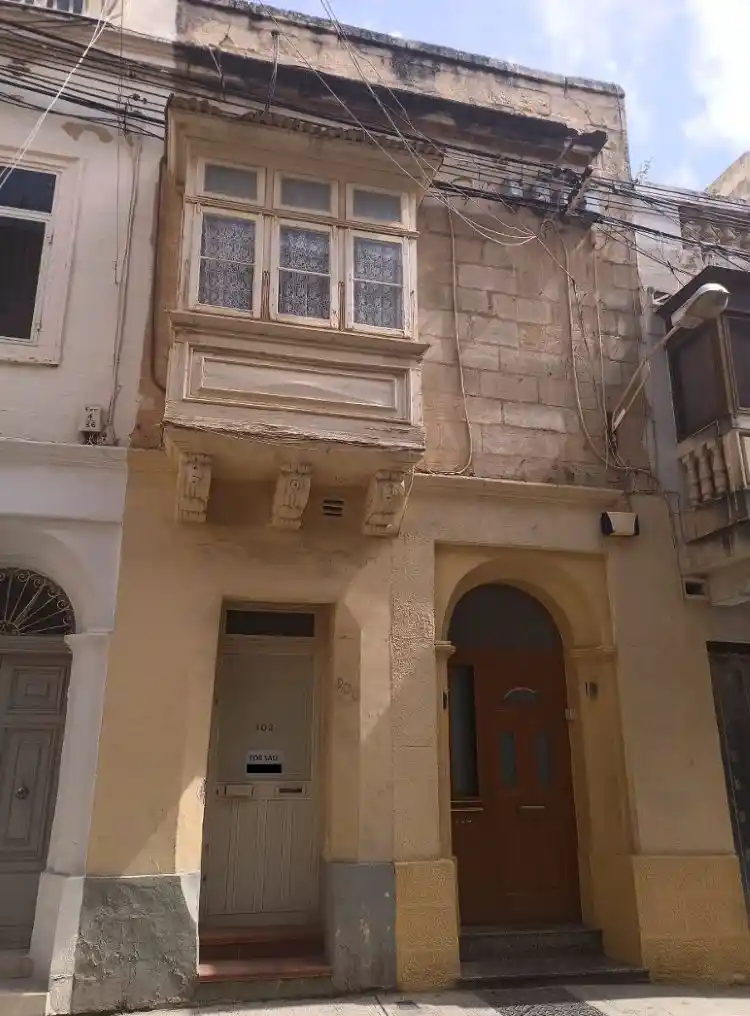
Typical Maltese house on a Sliema backstreet. The backstreets still have these. Give them five years, though — the developers are always circling.
Take the Ferry to Valletta
The Sliema–Valletta ferry is the main reason I’d choose this area over anywhere else on the island. It runs roughly every 30 minutes, takes about 15 minutes, and the views of Valletta’s fortifications as you cross Marsamxett Harbour are worth the trip alone. I take it regularly instead of driving — it’s faster, cheaper, and saves you the misery of trying to park in Valletta.
- Single: ~€2 (daytime), slightly more at night
- Return: ~€3.80
- With Tallinja card: FREE (card costs €25 to issue, includes free Barrakka Lift)
- Frequency: every 30 minutes
- Duration: ~15 minutes
Once in Valletta, the main sights are all walkable — Upper Barrakka Gardens, St. John’s Co-Cathedral, Fort St. Elmo, MUŻA national art museum (the museums guide helps if you’re choosing between them). There’s also a second ferry from Valletta to the Three Cities — easy to combine both in a day trip. If you’re still in the planning stage, the how to get to Malta page has flights and routes.
Some people say taking the ferry day after day gets tiresome. I disagree — I think it’s the highlight, not the chore — but if harbour crossings aren’t your thing, Valletta itself is a base option too. It costs more and the evening restaurant scene is thinner. The where to stay guide lays out the trade-offs.
Water Sports, Boat Tours, and the Water Taxi
Sliema Ferries is the main departure point for boat tours:
- Blue Lagoon day trip (Comino) — from ~€20 (basic transfer) to €50+ (catamaran with food). Multiple operators, daily in season. Full Comino guide
- Grand Harbour cruises — a loop around the fortifications of Valletta, Senglea, and Birgu. Usually about 90 minutes
- Sunset cruises — several companies run these from Sliema Ferries, usually May through October. Book a day or two ahead in summer
- iSeeMalta hop-on/hop-off ferry — connects Sliema, Valletta, and the Three Cities with multiple stops around both harbours
- Water taxi — smaller boats that run on-demand or semi-scheduled routes across the harbours. Handy if you want to reach Valletta or the Three Cities outside the main ferry timetable, or if you just want the experience of crossing by traditional dghajsa. Expect around €5–10 per crossing depending on the route and whether you’re sharing the boat
For active water sports, operators along the promenade rent out jet skis, paddleboards, kayaks, and parasailing gear in summer. Malta’s water clarity also makes it good for diving — there are dive centres in Sliema itself, and the wreck diving guide lists sites within a short boat ride. If you’re new to it, the scuba primer and common mistakes piece are worth a read first.
Day Trips from Sliema
Malta is 27km long — you can reach anywhere on the island within an hour. Sliema’s bus connections and ferry terminal mean you don’t need a car.
- Valletta — 15 min by ferry. UNESCO city, full of museums and restaurants. Walk it yourself
- The Hypogeum — 5,000-year-old underground temple in Paola. Book weeks ahead — numbers strictly limited. More here
- Ħaġar Qim & Mnajdra — megalithic temples older than Stonehenge, south coast. Visit them
- Mdina — the walled “Silent City.” Bus 202 from Sliema. Mdina’s lesser-known gems
- Comino & the Blue Lagoon — boat from Sliema Ferries. Complete guide
- The Three Cities — Birgu, Senglea, Cospicua. Ferry from Valletta. Three Cities hub
- Mountain biking — rural routes away from the coast. Guide
- Rock climbing — cliff routes on the west coast. Guide
There are more — 20 day trips from Sliema and Gżira has the lot.
Where to Eat in Sliema
Sliema has an absurd density of restaurants. The problem isn’t finding somewhere to eat — it’s finding somewhere good among the tourist traps. A few that I’ve been to more than once:
- Ta’ Kris 📍 Map (Fawwara Lane) — traditional Maltese cooking. The stuffat tal-fenek (rabbit stew) is the dish to order. Enormous portions. Book ahead on weekends.
- Sea Salt 📍 Map — small, no-fuss seafood. Fresh octopus, daily fish specials. I keep going back because the quality doesn’t wobble
- For pizza, Vecchia Napoli 📍 Map does wood-fired pies that compete with anything on the island. Casual, reasonably priced, and often packed — you might wait for a table on Friday nights
- The Chophouse 📍 Map has a harbour view toward Valletta and serves proper steaks, but you’ll pay for the setting. Save it for a birthday or an anniversary
- Caffè Berry 📍 Map (near the ferry terminal) — pistachio or hazelnut coffee, vegan cakes. Not a restaurant, but good to know about when you’re waiting for the boat
For street food, look for pastizzi — Malta’s national snack, a flaky pastry filled with ricotta or mushy peas. You’ll find pastizzerie scattered through the backstreets. They cost under €1. There’s a recipe with variations if you want to try making them at home, and the Maltese wine guide pairs well — Girgentina and Gellewża are two grape varieties you genuinely won’t find outside Malta.
If you’re self-catering, the Sunday fish market in Marsaxlokk sells fresh catches you can cook yourself — bus 81 from Valletta. There’s also a small fruit and veg stall that occasionally sets up near the promenade kiosks.
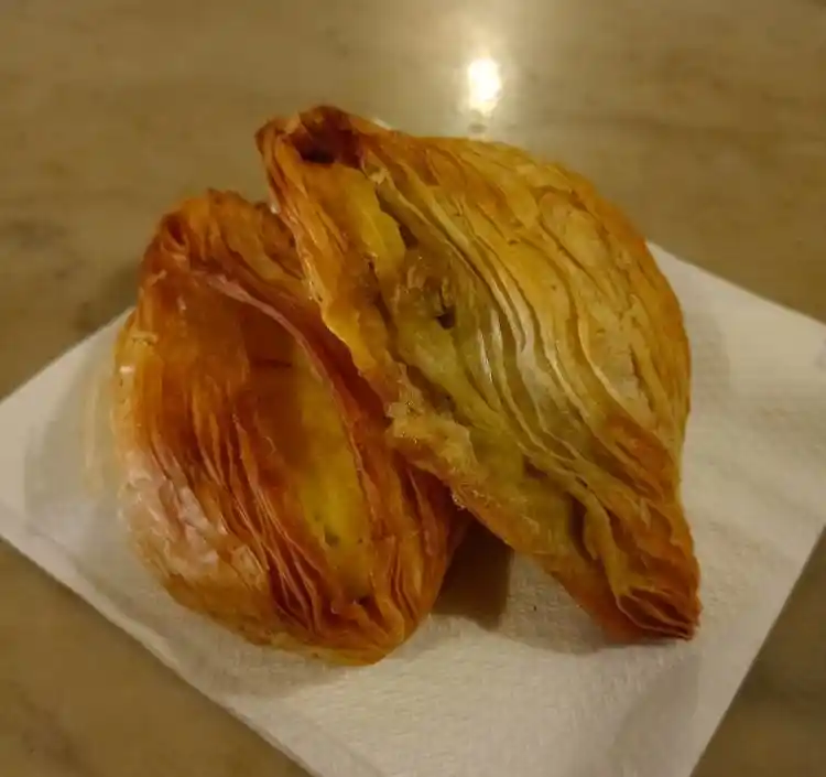
Under a euro, still warm, eaten on the street corner. The ricotta ones are better. I’ll fight about this.
Nightlife
Sliema has a string of bars clustered together near the seafront — from Black Gold Saloon 📍 up to The Black Sheep 📍, all practically next door to each other. They serve the usual drinks and some good platters, and between them you’ll find karaoke nights, sports screens, live music, and whatever else fills the calendar that week. They stay lively late at night, especially on weekends and most days in summer.
That said, this is not St Julian’s or Paceville. Sliema nightlife is more of a let’s-have-a-party-sitting-down kind of thing than a jumping-up-and-down one. If you want actual clubs and late-night energy, Paceville is the place:
- About a 10-minute taxi or 20-minute walk north along the promenade
- Night bus N3 runs from Valletta through Sliema on Friday/Saturday nights until ~4am (€3)
Sliema’s bar scene also has the quieter end — cocktail places, wine bars, hotel rooftops with views. It suits couples and older travellers as much as groups looking for a night out. Check the cultural events calendar and the summer 2026 music festivals before you book — there might be something on.
Annual Events and Festas
Malta’s village festas — parish saint celebrations with fireworks, marching bands, and street decorations — run from May to September. Sliema’s main festa is for Stella Maris (Our Lady Star of the Sea), usually on the third Sunday of August. The church and surrounding streets get decorated with lights and banners, there are fireworks over the harbour, and the noise from the petards alone will wake you at 6am whether you planned to attend or not. The Stella Maris Parish Facebook page posts updates and timings in the weeks before the feast. Dates for all parishes are in the festa calendar 2026. If you’ve never experienced a Maltese festa, make the effort.
Other events that run through Sliema during the year:
- La Valette Marathon — runs through part of the promenade
- Harbour regattas — traditional rowing races between harbour towns, usually around September
- National celebrations like Republic Day
- The occasional open-air cinema screening or charity event along the waterfront in summer
- Easter processions — the Easter in Malta guide explains what happens and where
Getting Around Sliema
Sliema is compact and walkable. The promenade runs along one side, The Strand (harbour road) runs along the other, and the town centre sits between them. You can cross coast to coast in about 10 minutes on foot.
Buses:
- Routes 13 and 14 — Valletta via Msida
- Route 202 — to Rabat/Mdina
- Route 222 — to Buġibba
- TD3 — airport express via Gżira, every 30 min (€3)
- Main stops: Sliema Ferries and along the promenade
- Download the Tallinja app for real-time arrivals
- Fares: €2/ride (valid 2 hours), €3 at night, €21 for a 7-day Explore card
Taxis and ride-hailing: Bolt and Uber both work in Malta. eCabs is a local alternative. All are cheaper than street taxis. Airport from Sliema: about €12–15 via app.
Driving and parking: Don’t. Streets are narrow, one-way systems are confusing, and on-street parking is nearly impossible. Use the car park at The Point mall if you must. More on whether renting a car in Malta makes sense.
Practical Stuff: Supermarkets, Pharmacies, and Daily Costs
If you’re staying in a self-catering flat for more than a couple of nights, you’ll want to know where to buy groceries, find a pharmacy, and what things actually cost day to day.
Supermarkets:
- Tower Supermarket 📍 Map (Tower Road, near the fork with Next) — well-stocked, reasonable prices
- Welbee’s — High Street area
- The Point mall 📍 Map — has a supermarket inside
- Scott’s 📍 Map (Amery Street) — opens Sunday mornings until 12:30pm
- Smaller convenience stores scattered through backstreets, some open Sundays
- Most smaller shops close for lunch (noon–3pm) and reopen in the afternoon
Pharmacies:
- Large Chemimart 📍 Map branch on Tower Road (about 100m past Next, set slightly back)
- Malta’s system is different: pharmacists are highly qualified and advise on common ailments directly
- Many pharmacies have a GP who visits on set hours — consultation costs around €15–20 plus medication. No appointment, you just wait
- There’s a duty pharmacy rota for nights and weekends — your hotel or host should have the current list, or check the Times of Malta website
If you need a doctor beyond what a pharmacy can handle, Saint James Capua Hospital 📍 Map is right in Sliema on George Borg Olivier Street — Malta’s largest private hospital, with an ER open around the clock, outpatient clinics, and a lab. For anything life-threatening, the main public hospital is Mater Dei in Msida, about 10 minutes by car. The Sliema Police Station 📍 Map is on Triq Manwel Dimech (273/274), also open 24 hours — phone +356 2133 0502, or call 112 for emergencies anywhere in Malta.
The Sliema Local Council 📍 Map is on the same street. Mostly relevant if you need to ask about a parking issue or a street closure, but their website (sliemalc.gov.mt) sometimes posts notices about roadworks that might affect where you’re staying. If you’re in a self-catering flat, their waste management page has the bin collection schedule — useful to know which day your bags go out.
Delivery apps: Bolt Food and Wolt deliver from Sliema restaurants. Some supermarkets deliver orders over ~€75. Useful for stocking a kitchen on arrival day.
Wi-Fi: Free in most cafés and public spaces. For reliable work-from-café connectivity, the larger places on Tower Road and Bisazza Street are best. See remote work from Malta.
Rough daily budget:
- Budget day (bus, pastizzi snack, casual lunch, mid-range dinner): €40–60/person
- With extras (boat tour + taxi): €70–90/person
- Self-catering groceries for two, per week: about €60–80 from Tower Supermarket
- Sliema is one of the pricier areas in Malta, but still far cheaper than most western European cities
Where to Stay in Sliema (and Nearby)
You can stay in anything from a five-star seafront hotel to a backstreet flat with a washing line on the balcony. For a trip of more than a few days, self-catering apartments make more sense than hotels:
- You get a kitchen — shop at Tower Supermarket, cook Maltese ingredients, save a fortune on eating out
- After a week of 35°C heat, a washing machine matters more than you’d think
- Space-wise, even a modest Maltese flat beats most hotel rooms — you’ll have a living area, usually a balcony
- Bolt Food delivers from Sliema restaurants, so you get room service without the hotel markup
Many flats have traditional Maltese balconies or back terraces. This is the kind of area where you can actually live for a week, not just pass through.
Nearby Gżira — about 10 minutes’ walk south along the harbour — is a quieter, more residential alternative. It doesn’t have Sliema’s shopping or restaurant density, but it has its own stretch of waterfront with direct views across to Valletta, it’s right next to the bridge to Manoel Island, and accommodation tends to be more affordable. The bus connections are the same (TD3 airport express stops in Gżira too). The where to stay in Malta guide compares all the main areas, and there’s a separate hotel vs Airbnb breakdown if you’re deciding on accommodation type.
Best Time to Visit Sliema
The sweet spots are April–June and September–early November. Temperatures sit around 20–28°C — warm enough for swimming, cool enough for walking. Crowds are manageable and accommodation prices drop noticeably from the summer peak.
July and August: hot — often above 35°C. Sliema fills up completely. Promenade packed, boat tours overbooked, prices spike. Summer festas and music festivals are the upside.
Winter (December–February): mild by northern European standards (12–16°C daytime) but too cool and rough for swimming most days. Good for exploring Valletta, Mdina, and the temples without crowds. Bring a jacket, expect occasional heavy rain — the weather shifts between sunny and windy faster than you’d expect, sometimes in the same afternoon. The month-by-month weather guide and packing list go into more detail.
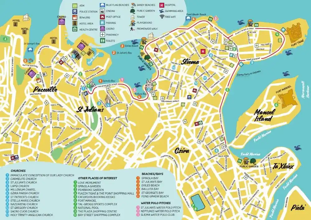
Map of Sliema (Credit : VisitMalta)
Frequently Asked Questions
Is Sliema a good base for exploring Malta?
Yes — hard to beat. Ferry to Valletta in 15 minutes, buses to anywhere on the island, boat tours to Comino from here. Main downside is traffic, which the ferry sidesteps.
Should I stay in Sliema or Valletta?
The most common debate on travel forums. Sliema has more accommodation at every price point, better shopping and supermarkets, and a wider evening restaurant scene. Valletta has the history, museums, and bus terminus — but it’s quieter at night. They’re 15 minutes apart by ferry. If budget allows, spend a night or two in each.
Are there sandy beaches in Sliema?
Not really. Balluta Bay has a small pebbly stretch, and there are rocky swim spots with ladders and tidal pools. For sandy beaches, take a bus to Golden Bay, Mellieħa Bay, or Għajn Tuffieħa.
How do I get from Malta Airport to Sliema?
The TD3 airport express runs directly to Sliema and Gżira every 30 minutes. It has luggage space, Wi-Fi, and USB charging. Fare: €3. A Bolt or Uber costs about €12–15.
Is Sliema safe for tourists?
Malta is generally very safe, and Sliema is densely populated and well-lit at all hours. Normal precautions — watch belongings on crowded buses, mind uneven limestone paving after dark.
What is the Sliema to Valletta ferry price?
~€2 single (daytime). A personalised Tallinja card (€25 to issue) gives free ferry travel plus discounted bus fares. Ferry runs every 30 minutes, takes about 15 minutes.
What are the “Roman Baths” in Sliema?
Rock-cut tidal pools at Fond Għadir, dating from the 19th century (not Roman — the name is misleading). Originally salt pans, converted to bathing pools during the British era. Free to use, great for swimming and snorkelling.
Can I visit Comino from Sliema?
Yes — most boat tours to Comino’s Blue Lagoon depart from Sliema Ferries. Daily in season, from ~€20 (basic transfer) to €50+ (catamaran with food).
Are shops and supermarkets open on Sundays?
Bigger supermarkets are closed or have limited hours (morning only, closing by ~12:30pm). Smaller convenience stores generally open, though some close for lunch. The Point mall opens with restricted hours. If arriving Sunday, grab essentials at the airport shop or use a delivery app.
Is Sliema good for remote workers and digital nomads?
It works. Free Wi-Fi in most cafés, co-working spaces nearby, and the iGaming industry has brought in a big international community — you won’t be the only person working from a laptop.
What is Fort Tigné?
A polygonal fort built by the Knights of St John between 1793 and 1795 — their last major fortification. One of the oldest polygonal forts in the world, on Malta’s tentative UNESCO list since 1998. Restored in 2008.
Is Sliema or St Julian’s better to stay in?
Sliema: more practical for sightseeing — better ferry access, more shops, quieter evenings. St Julian’s: better nightlife (Paceville) and beach-bar culture around Spinola Bay. They’re adjacent and connected by the promenade, so you get both regardless of where you sleep.
How much should I budget per day in Sliema?
A comfortable day: roughly €40–60 per person (bus, lunch, dinner). Add boat tours or taxis and it’s €70–90. Self-catering cuts food costs — a week’s groceries for two: about €60–80.
One last thing: if you find a spot on the rocks near Fond Għadir on a calm evening, with the Valletta skyline turning gold across the water and a cold Cisk in hand from one of the promenade kiosks, you’ll understand why people keep coming back despite everything I’ve just said about the traffic and the construction and the lack of sand. And if you’re still not sure whether Malta is for you at all, this page is honest about who it suits and who it doesn’t.
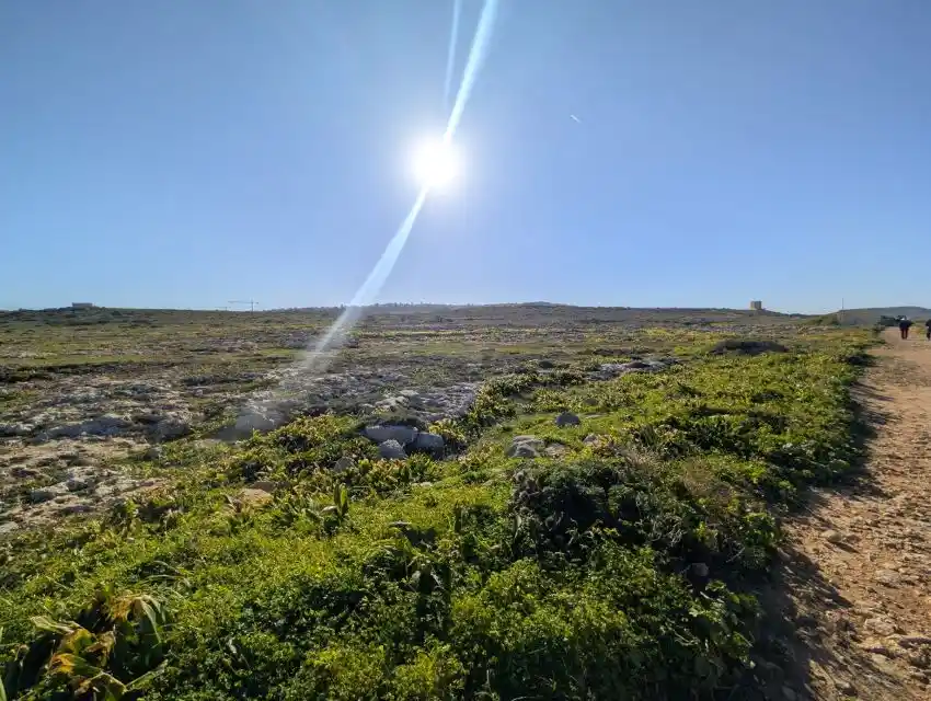
This is not Sliema — it’s Pembroke, about 25 minutes away by bus. Sliema has the sea as its wide-open space because the interior is packed. If you need green and breathing room, Pembroke 📍 Map is close enough to feel like an escape.
Stay in Gżira near the promenade
A designer 2-bedroom apartment in Gżira, close to the church, around 2 minutes from the promenade, and near Manoel Island.
View on Airbnb