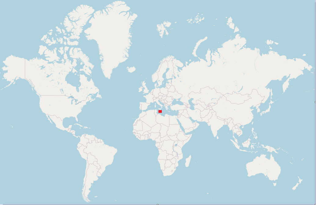
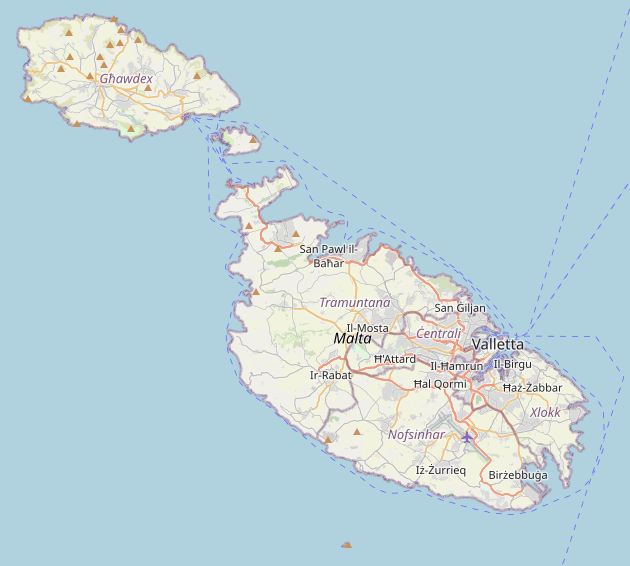
Malta is in the central Mediterranean, about 93 km south of Sicily and roughly 300 km north of Libya. It is an independent island country made up of Malta, Gozo, and Comino. The whole place covers 316 km², so distances are short and the sea is never very far away.
If you are trying to work out where Malta is, the basic answer is easy enough: it is a small island country in the Mediterranean, just below Sicily. That said, the map matters here more than it does in a lot of destinations. Malta’s position explains a lot of what people notice once they get here, from the language to the forts to the way the islands always seem to turn back toward the sea.
This page is meant to answer the geography question properly. Not every page about Malta does that. Some drift straight into beaches, hotel areas, or generic travel filler. Useful in their place, but not really the point here.
Where is Malta on a map?
Malta sits in the central Mediterranean, south of Sicily and north of Libya. If you are looking for Malta on a Europe map, start with southern Italy and then look down into the sea. It is a small dot, easy to miss at first glance, but once you find it the position makes immediate sense.
It also helps to be precise about what kind of place Malta is. It is not part of mainland Europe. It is not part of Italy. It is not some remote Atlantic island either. It is a small archipelago on its own, sitting between bigger shores and shaped by that fact for a very long time.
That location, close to both Sicily and North Africa, is one reason Malta does not feel quite like anywhere else. You can see it in the history, hear it in the language, and notice it in the food without needing anyone to make a speech about it. If you want the political side of the question, see Is Malta a Country?
The Maltese archipelago
Malta is a country made up of islands. The three inhabited ones are Malta, Gozo, and Comino.
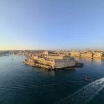
- Malta is the main island. The airport is here, Valletta is here, and most of the busiest urban areas are here too.
- Gozo is smaller and slower, with more of a rural feel.
- Comino is tiny and is mostly known for swimming, boats, and the Blue Lagoon.
That sounds obvious, but it clears up one common confusion. When people say they are “going to Malta,” they may mean the country, or they may just mean the main island. Usually context does the work. Still, it is worth knowing from the start.
There are also smaller uninhabited islets and rock formations around the archipelago, including Filfla, St Paul’s Islands, Cominotto, and Fungus Rock. They matter more once you get into Malta’s geography in detail, but for most readers the main thing to know is that this is more than a single island with a flag attached to it. We cover part of that in more depth in the Comino and Cominotto guide.
How big is Malta?
The Republic of Malta covers 316 km² in total. It is small. There is no point pretending otherwise. But it does not feel empty or remote. Quite the opposite. The islands are tightly packed, heavily used, and full of quick shifts between harbour towns, apartment belts, old cores, beaches, cliffs, and bits of farmland.
This catches people out. On paper Malta looks almost toy-sized. In real life it feels dense, urban in places, and surprisingly layered for somewhere you can cross without much drama.
The numbers help explain that feeling. Malta has about 574,250 residents, around 457,403 licensed motor vehicles, and more than 4 million inbound tourists across a year. For a country of 316 km², that is a lot of movement, pressure, and turnover compressed into a very small footprint. It helps explain why roads can feel crowded, why the harbour belt feels busy, and why season and timing make such a difference. If you are weighing transport properly, see Should You Rent a Car in Malta?
Official name: Republic of Malta
Area: 316 km²
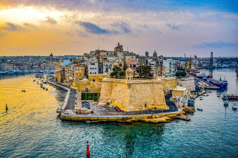
Capital: Valletta
Population: about 574,250
Licensed motor vehicles: about 457,403
Inbound tourists in 2025: about 4,022,310
Official languages: Maltese and English
Currency: Euro
Time zone: Central European Time / Central European Summer Time
Driving: Left-hand side
Electricity: Three-pin rectangular plugs
Emergency number: 112
Why the location matters
History
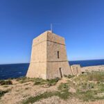
Malta’s position in the middle of the Mediterranean made it valuable for a long time. That is the short version. If you look at the islands and wonder why there are so many forts, old harbour towns, defensive walls, and layers of occupation packed into such a small space, the map is the place to start.
Phoenician, Roman, Arab, Knight, French, and British periods all left marks behind. You do not need the full timeline here, but you do need the basic idea: Malta was not tucked away from Mediterranean history. It sat in the middle of it. For the longer version, there is the Malta history hub.
Language and culture
Malta also sounds different from what many visitors expect. Maltese and English are both official languages, and the mix reflects Malta’s position between different worlds rather than neat belonging to just one. That carries over into daily life as well. The islands are Mediterranean, clearly, but not in a copy-and-paste way.
This is part of why the place can feel slightly odd at first, in a good way. Familiar in some respects, hard to classify in others.
Climate
Malta’s southern position brings long dry summers and mild winters. That is part of the reason people travel here well outside peak summer. Some come for swimming and boats in the hotter months. Others prefer spring, autumn, or winter light, when the islands are easier to move around and the heat is less tiring.
The climate reinforces the sea-focused side of the country too. Harbours, ferries, swimming places, and coastal views are part of normal life here. Even built-up areas rarely feel far from the water. For the seasonal side, see Weather in Malta by Month, Malta in October, and Is Malta Right for You?
Practical facts for visitors
Most visitors arrive through Malta International Airport on the main island. English is widely used, which makes first-time travel fairly straightforward. Malta is also part of the Schengen Area, which matters if you are moving around Europe on the same trip.
Two smaller practical details are worth knowing early: Malta drives on the left, and it uses the three-pin rectangular plug familiar from the UK. For the transport side in more detail, see How to Get to Malta and Should You Rent a Car in Malta?.
Frequently asked questions about Malta
Is Malta a country or an island?
Both. Malta is an independent country made up of an archipelago of islands. The main island is also called Malta, which is where some of the confusion comes from.
Is Malta in Europe?
Yes. Malta is a European country in political and practical terms. Geographically, it sits in the central Mediterranean south of Sicily.
Is Malta part of Italy?
No. Malta lies close to Sicily and has strong historical ties to Italy, but it is a separate country with its own language, institutions, and identity.
What language do they speak in Malta?
Maltese and English are both official languages. English is widely used in daily life and in tourism.
Which islands are part of Malta?
The three inhabited islands are Malta, Gozo, and Comino. There are also smaller uninhabited islets and rock formations around the archipelago.
How do most people get to Malta?
Most visitors arrive by air through Malta International Airport. It is also possible to reach Malta by sea from Sicily, depending on the season and timetable.
So where is Malta? It is a small island country in the central Mediterranean, south of Sicily and north of Libya. Simple enough on paper. In practice, the location explains more or less everything that makes the islands feel different once you spend time here.
Stay in Gżira near the promenade
A designer 2-bedroom apartment in Gżira, close to the church, around 2 minutes from the promenade, and near Manoel Island.
View on Airbnb